


West Highland Way - Route Map Print
West Highland Way - Route Map Print
Get it delivered for FREE between -
Couldn't load pickup availability
- Handcrafted & Made to Order
- Free delivery in 2-5 business days
- 30-day returns policy
Further information
Further information
| Printing method: | Giclée |
| Paper: | 200gsm (5.9oz/yd) Fine Art Paper |
| Texture: | Smooth |
| Finish: | Matt |
| Framed prints: | Each frame is hand crafted using high-quality solid wood, milled with simple clean lines and presented with a satin finish. |
| Frame dimensions: |
|
| Glazing: | To protect our prints from light damage and bleaching, we present them behind a layer of cast acrylic. A high quality material, it offers many benefits: including 92% optical clarity and 90% UV protection. What is more, as it is shatter-resistant, it is much safer than glass in your home or workplace. |
| Mounted / Passepartout prints: | All mounts ( passepartout) are made from premium textured, conservation grade FSC certified mountboard. They are 100% acid free and will not discolour or fade with age. |
Shipping
Shipping
Shipping is free to UK, US, Australia and EU countries.
UK Orders: All artwork is printed and shipped within the UK.
EU Orders: All artwork is printed and shipped within the EU, meaning no customs charges or unexpected import fees for EU customers.
USA Customers: All artwork is printed and shipped within the United States, so there are no import duties, tariffs or customs fees on delivery.
Australia Customers: All artwork is printed and shipped within Australia, so there are no import duties, tariffs or customs fees on delivery.
Your order will be with you within 4-10 business days (please note that this may be slightly longer during peak seasonal demand, or events outside our control).
Each map is shipped in robust packaging, ensuring it arrives in pristine condition. For prints, we use premium cardboard tubes and tissue paper to keep everything secure. For classic framed prints, we ship in specially designed heavy-duty cardboard packaging with reinforced corners to protect every aspect of the frame, plexiglass and print from any damage in transit.
For more information regarding shipping, please visit our Delivery & Returns page.
Returns
Returns
If you're not entirely happy with your order, simply return it to us within 30 days for a replacement or full refund.
Please read our full returns policy here.
Frame specifications
Frame specifications
For further details on our framing options, please visit our Framing Page.
Sustainability & additional information
Sustainability & additional information
All our wood and pulp is sourced from sustainably managed forests.
Sustainably-managed forests meet the needs of wildlife while supporting livelihoods and providing many other ecosystem services, such as carbon storage and flood risk mitigation.
Our maps are designed and curated by Mapelio, and incorporate map data from OpenStreetMap for the purpose of accuracy.
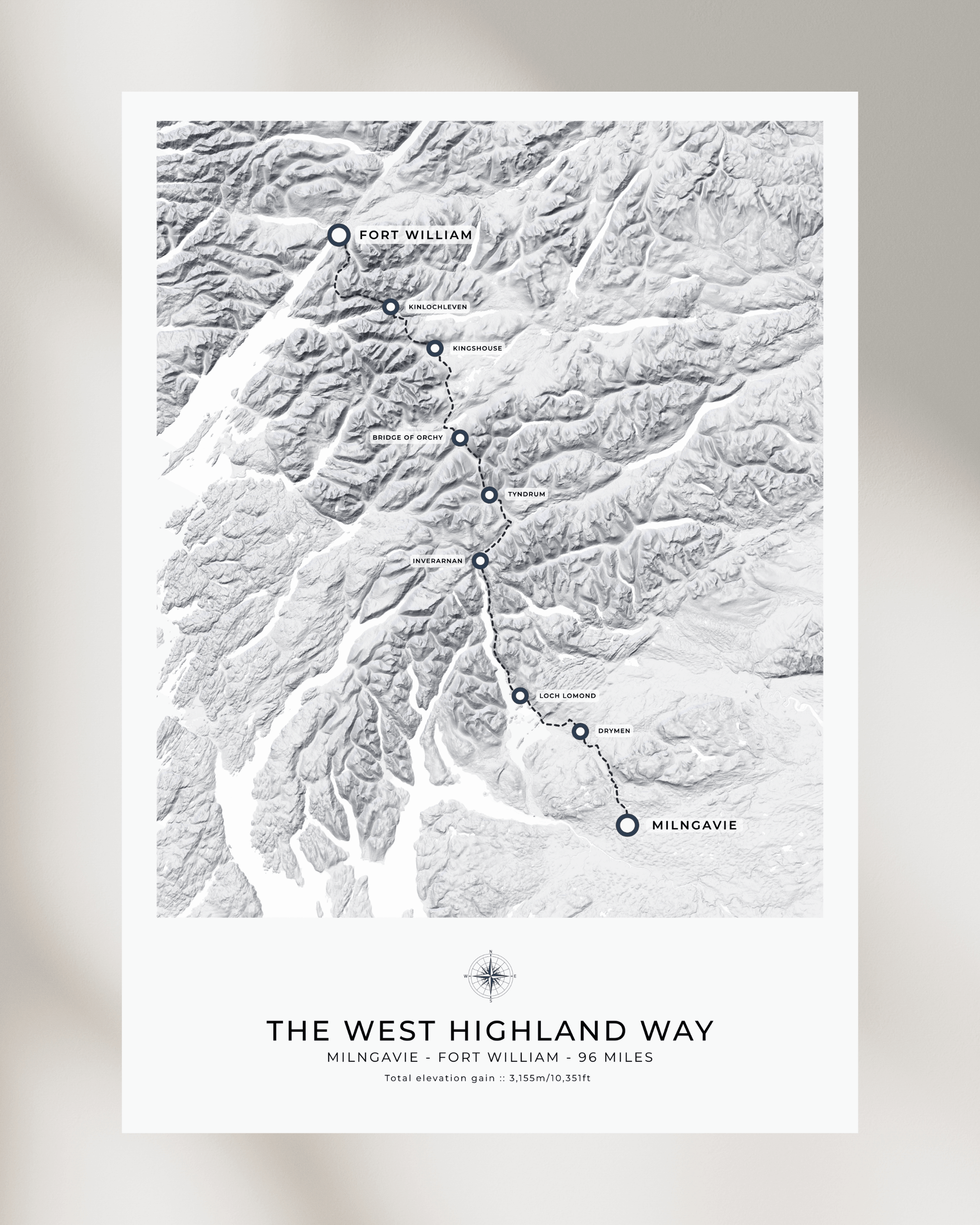
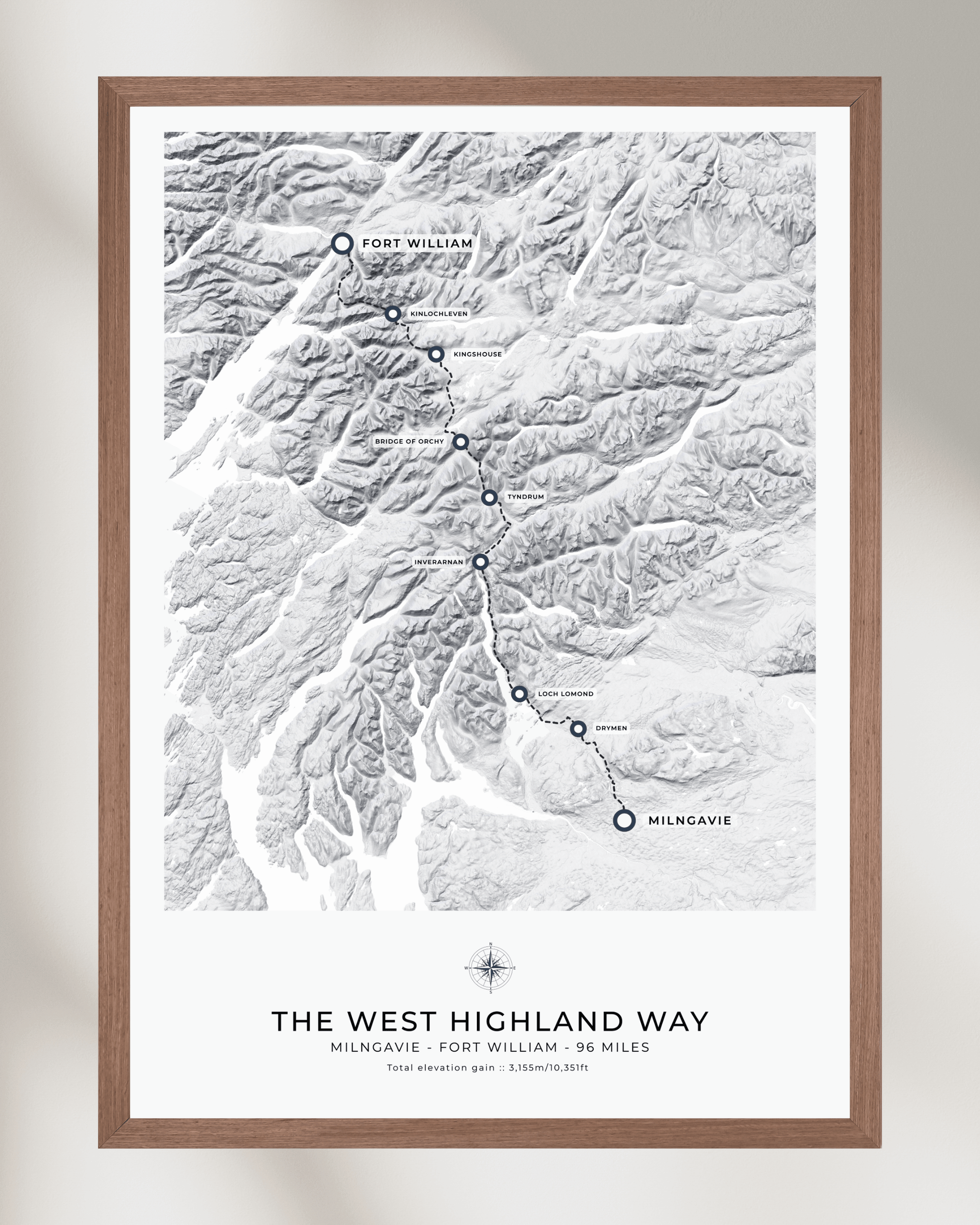
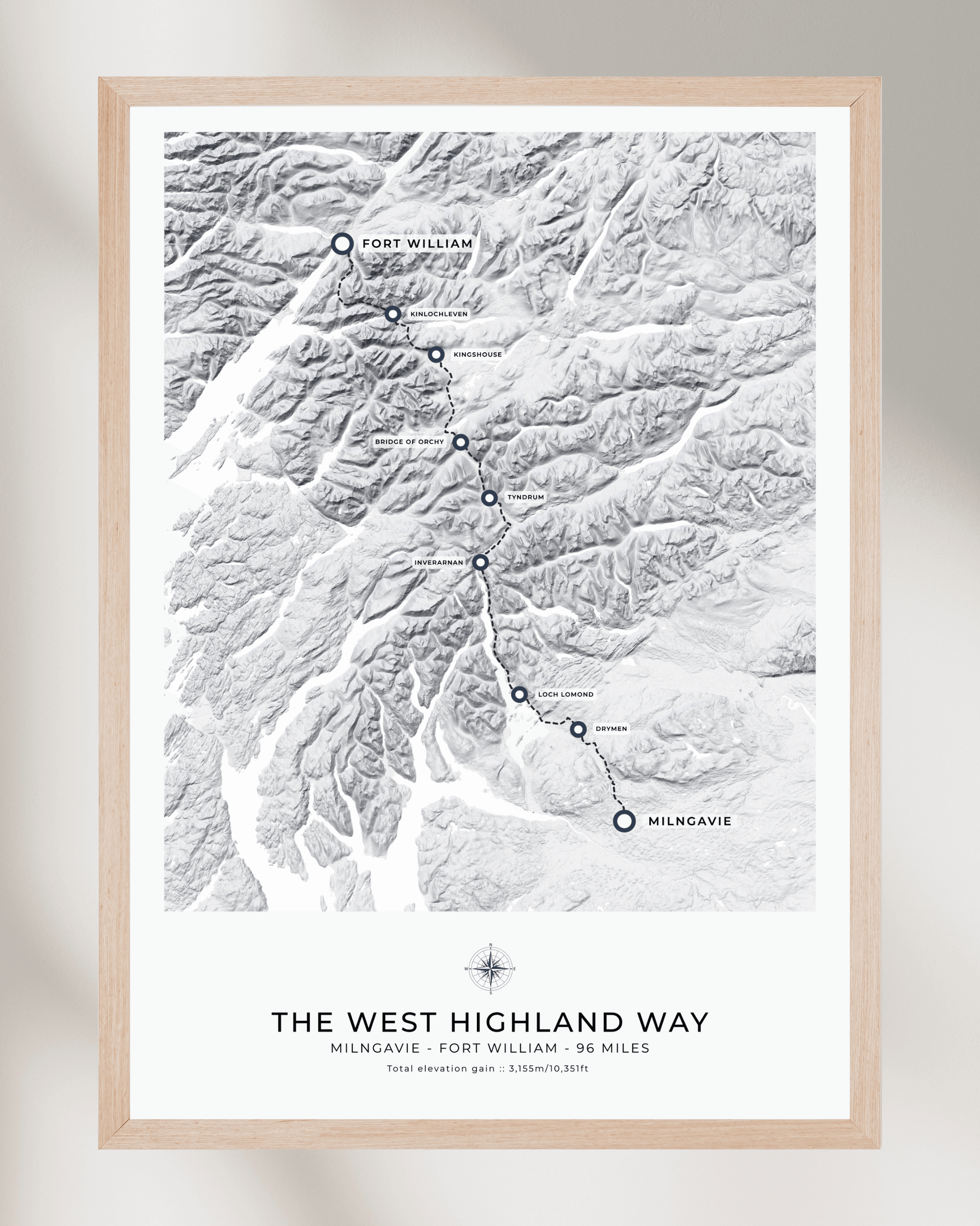
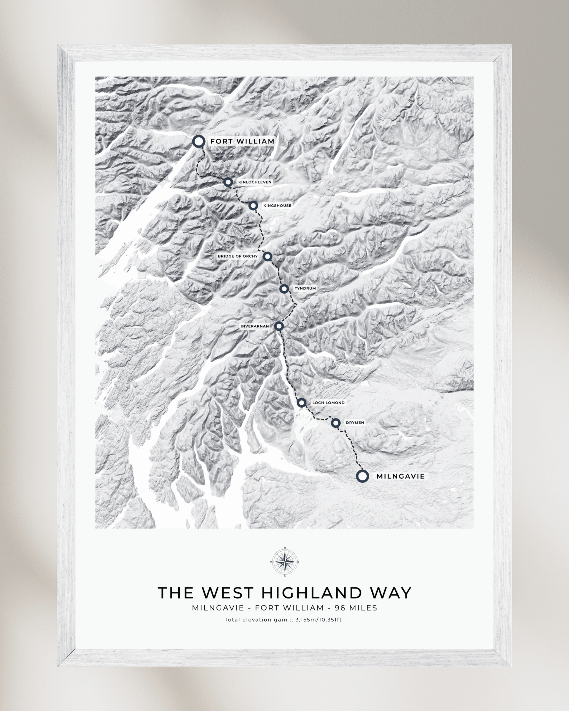
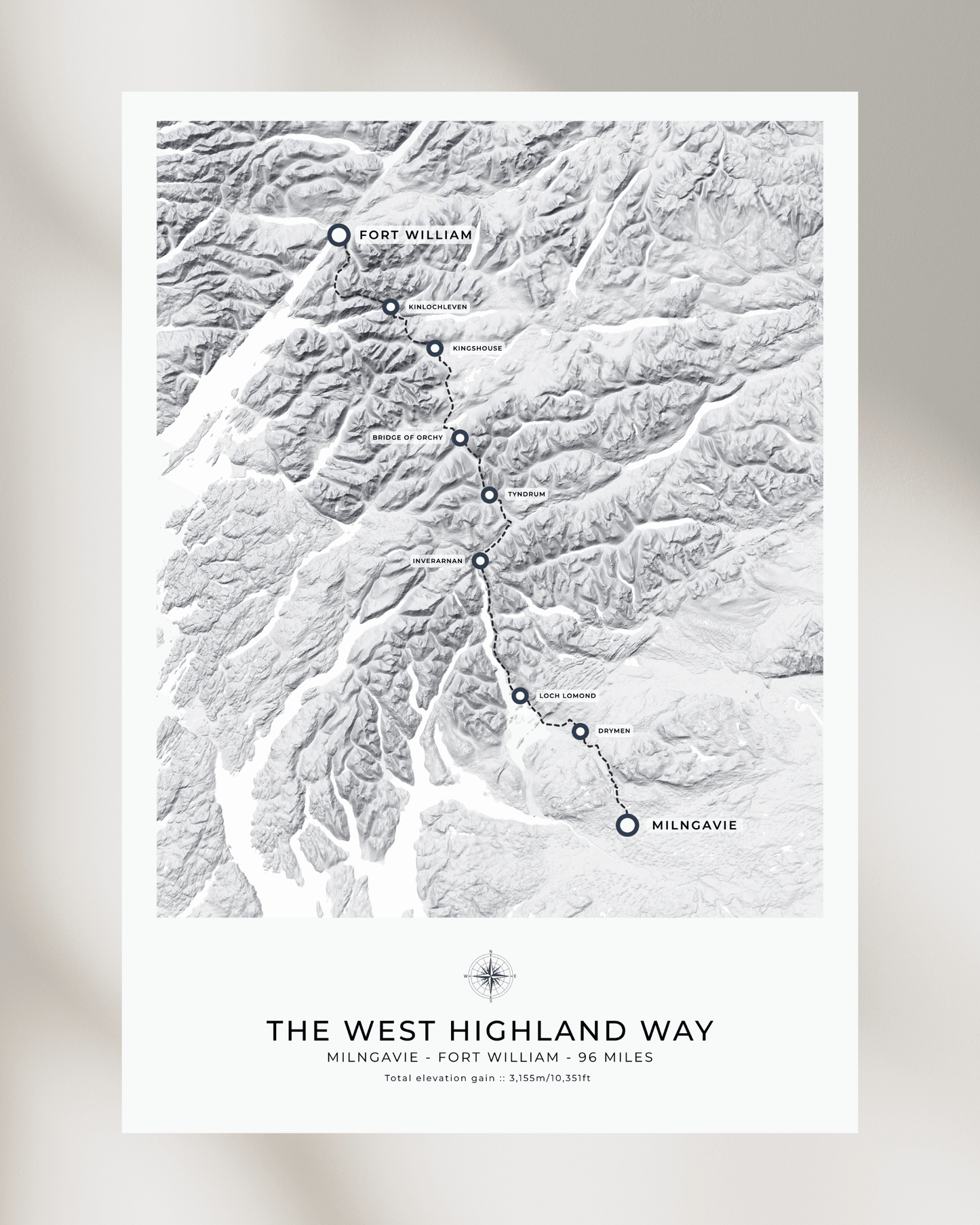
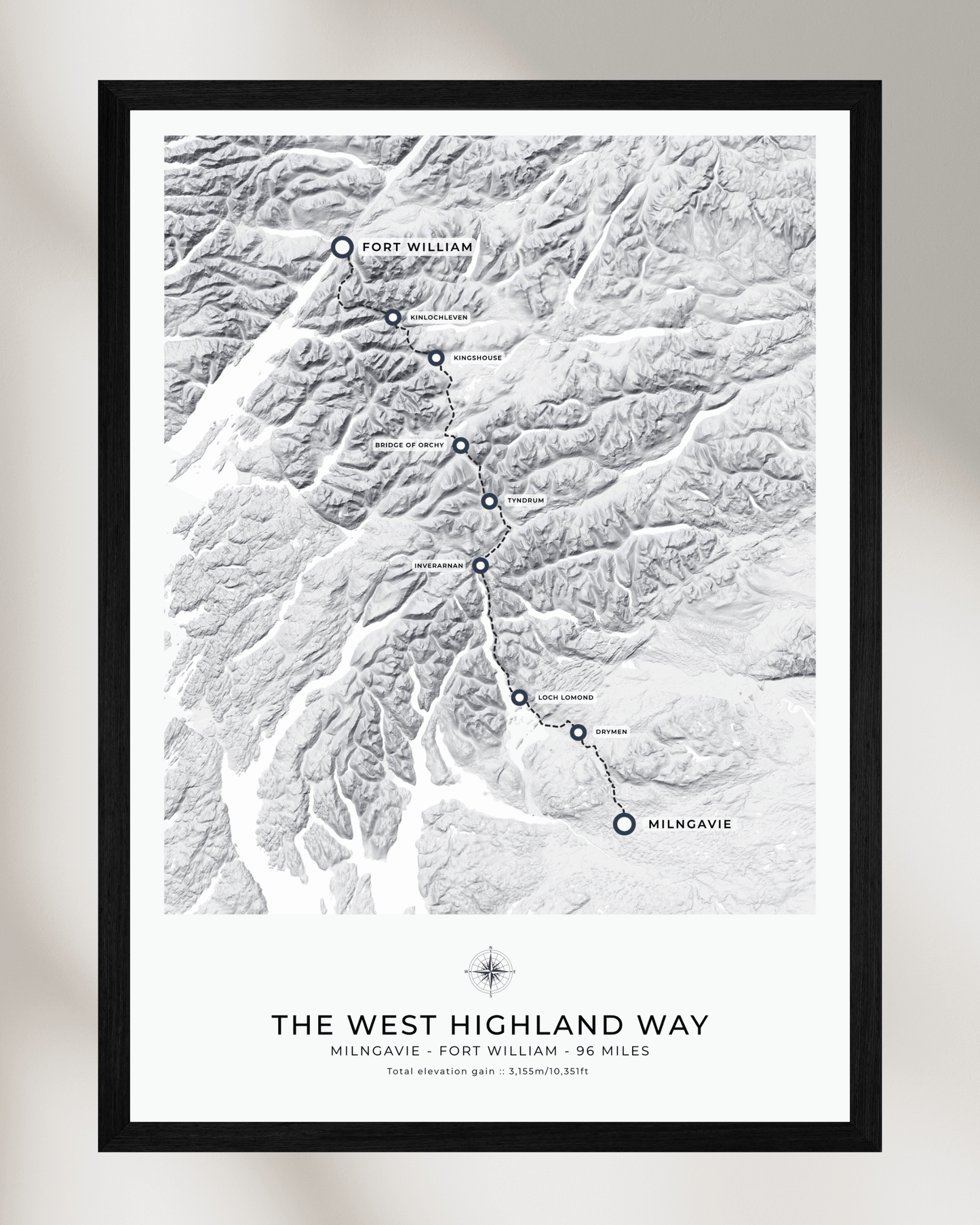
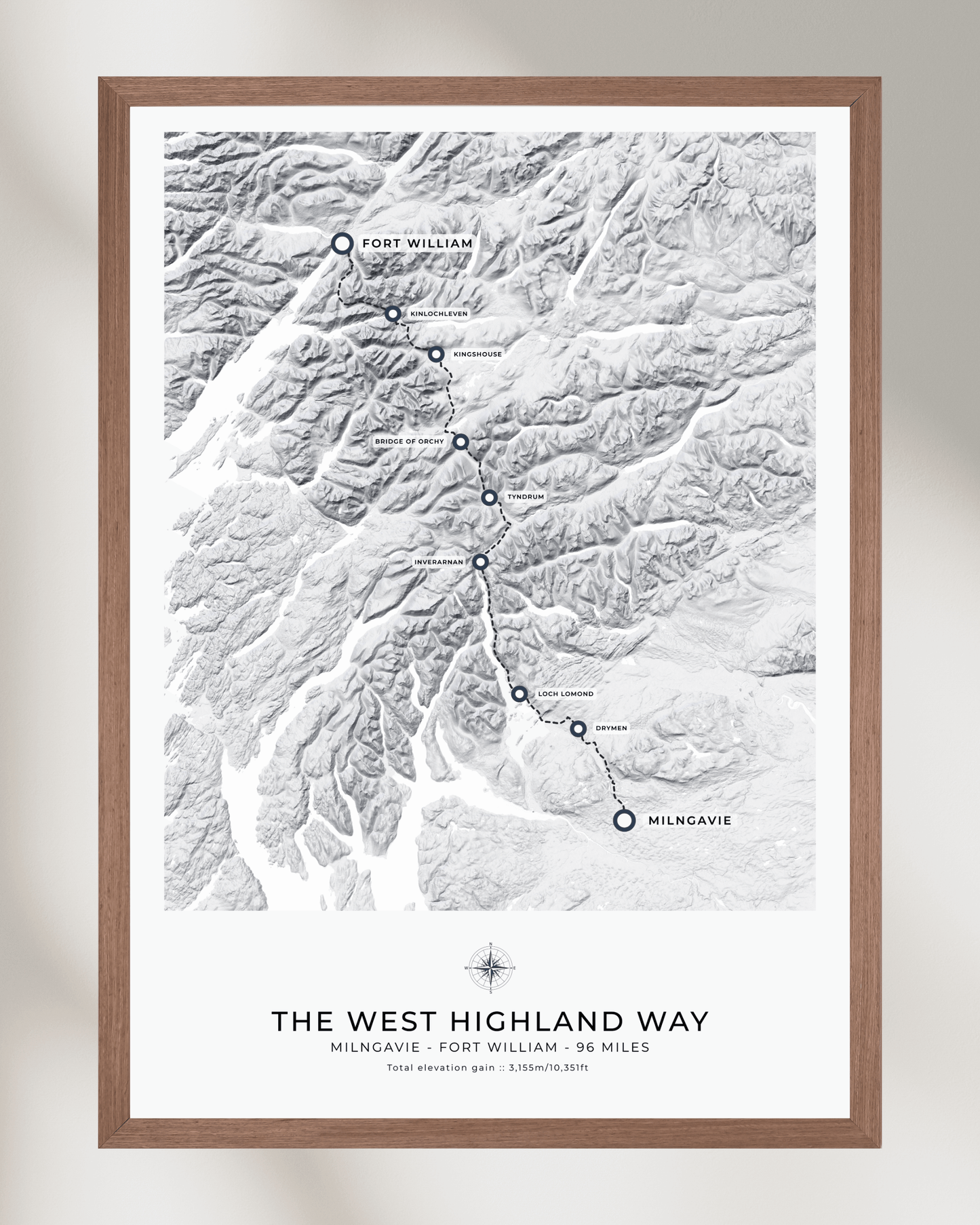
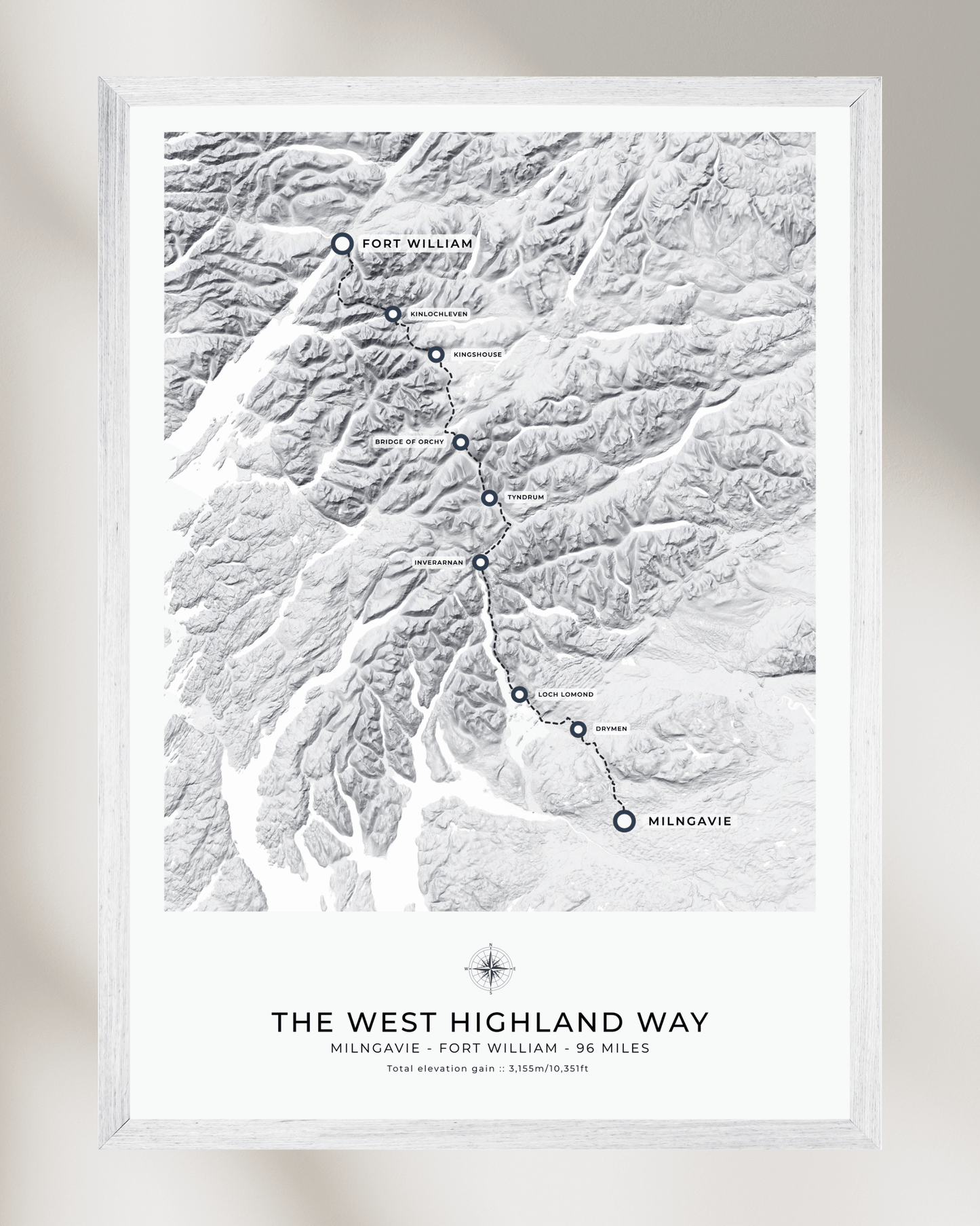
Spanning 96 miles (154 km) through the rugged and picturesque landscapes of Scotland, this trail is a must for any adventure enthusiast.
While you can tackle the West Highland Way from either direction, most adventurers prefer to start in the south at Milngavie, a charming town near Glasgow. From here, the trail gradually leads you through the more manageable lowlands before challenging you with the stunning highlands, culminating in the iconic finish at Fort William, nestled at the base of Ben Nevis, the UK’s highest peak.
As you traverse this legendary route, you’ll experience a diverse array of Scotland’s most breathtaking scenery. Wander through serene countryside parks, follow the tranquil shores of Loch Lomond, cross wild and enchanting moorlands, and be awestruck by majestic mountain vistas.
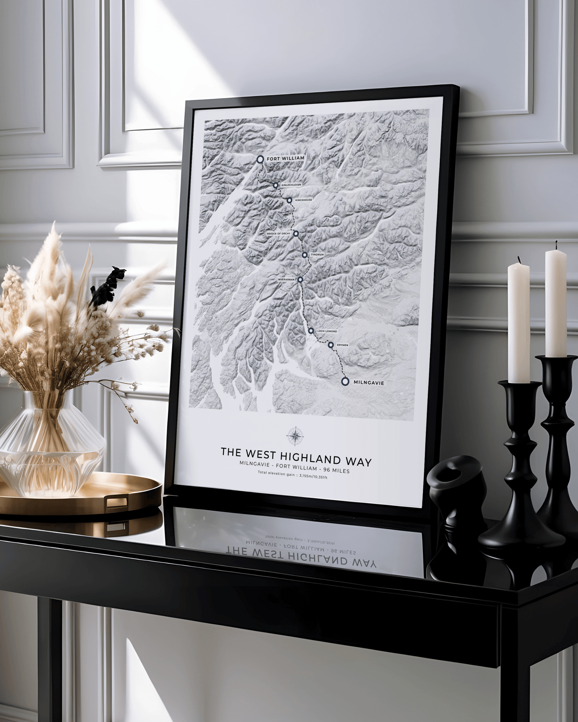
These maps are available as personalised prints (or framed prints) - please get in touch for further details and we'll send over a mock-up / proof for you to review before purchase.
FURTHER DETAILS
<<<<•>>>>
• Printed on enhanced 200g matte fine art museum quality paper, producing a rich, vibrant and clean finish. All our paper is sourced from FSC approved, sustainable forests.
• Each of our prints is available with a natural wood wooden magnetic poster frame, or ready-framed within a classic handmade frame made by specialist picture framers and fitted with shatterproof, transparent plexiglass to protect it from damage.
• All framed prints are delivered ready to hang in which ever room or office you choose.
• Each map is shipped in robust packaging, ensuring it arrives in pristine condition. For prints (and prints with hanging frames), we use premium cardboard tubes and tissue paper to keep everything secure. For classic framed prints, we ship in specially designed heavy-duty cardboard packaging with reinforced corners to protect every aspect of the frame, plexiglass and print from any damage in transit.
SHIPPING
<<<<•>>>>
• We provide free shipping on all our artwork.
• Full tracking details are sent upon dispatch.


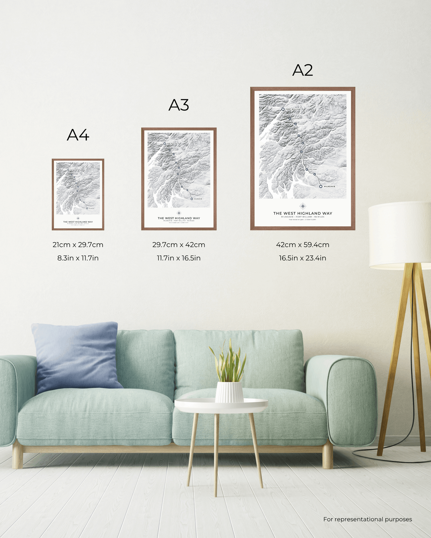
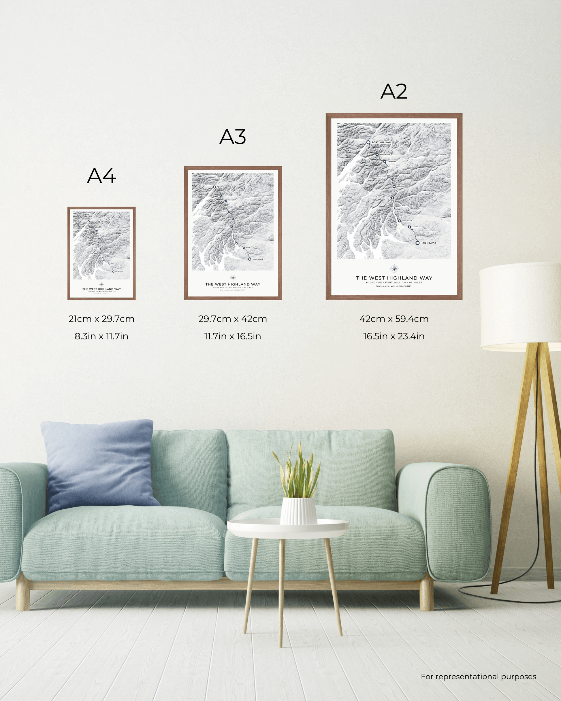
Size chart

Sizes are shown per individual print
For framed prints, the size listed for each artwork refers to the size of the glaze and does not include the width of the frame. For example, A4 prints without a mount will fit an A4 glaze exactly.
Framed prints with a mount will be slightly smaller than the listed size in order to fit the mount window opening. The size of the mounts for framed and mounted prints depends on the size of the frame:
- Frames 10x10” or below: 1” (25mm) mount Frames
- 11x14” or below: 1.5” (40mm) mount
- Frames 12x16” or above: 2” (50mm) mount
For example, an 18x24" framed and mounted print would have a print size of 14x20" due to the 2" mount on each side.