
The Shipping Forecast: Britain’s Most Enduring Maritime Ritual
For over a century, the Shipping Forecast has resonated like a low, familiar hum beneath the daily rhythm of British life. Broadcast twice a day (three times at the weekend) on BBC Radio 4, it offers maritime weather forecasts for 31 sea areas surrounding the British Isles.
With its litany of lyrical names (Dogger, Fisher, German Bight, Cromarty) and its cadence of precision and calm, the Forecast has transcended its nautical origins to become a cultural artefact in its own right.
Originally devised to protect lives at sea, the Shipping Forecast is the longest-running continuous weather bulletin in the world. Yet for many, it functions more like poetry than utility: a soothing invocation of distant waters and coastal winds. It speaks to Britain’s island identity, its maritime history, and the romance of the sea.
As a subject for cartographic representation, it is both technically challenging and culturally rich. It demands geographical accuracy, atmospheric nuance, and a keen sensitivity to its emotional resonance. It is little wonder, then, that interest in Shipping Forecast maps has grown steadily in recent years, especially among those seeking meaningful and design-led ways to reconnect with Britain’s maritime story.
So, let’s look at some of the most common questions people ask about The Shipping Forecast
What exactly is the Shipping Forecast?
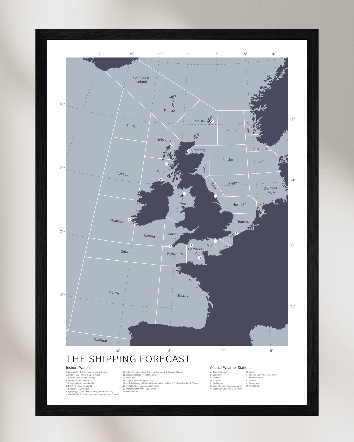
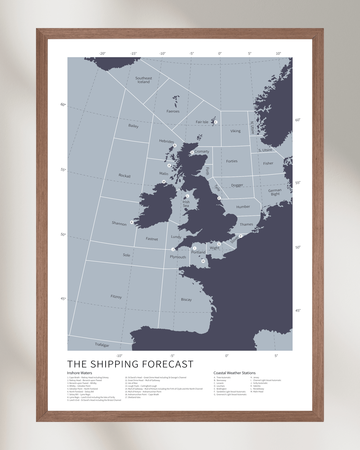
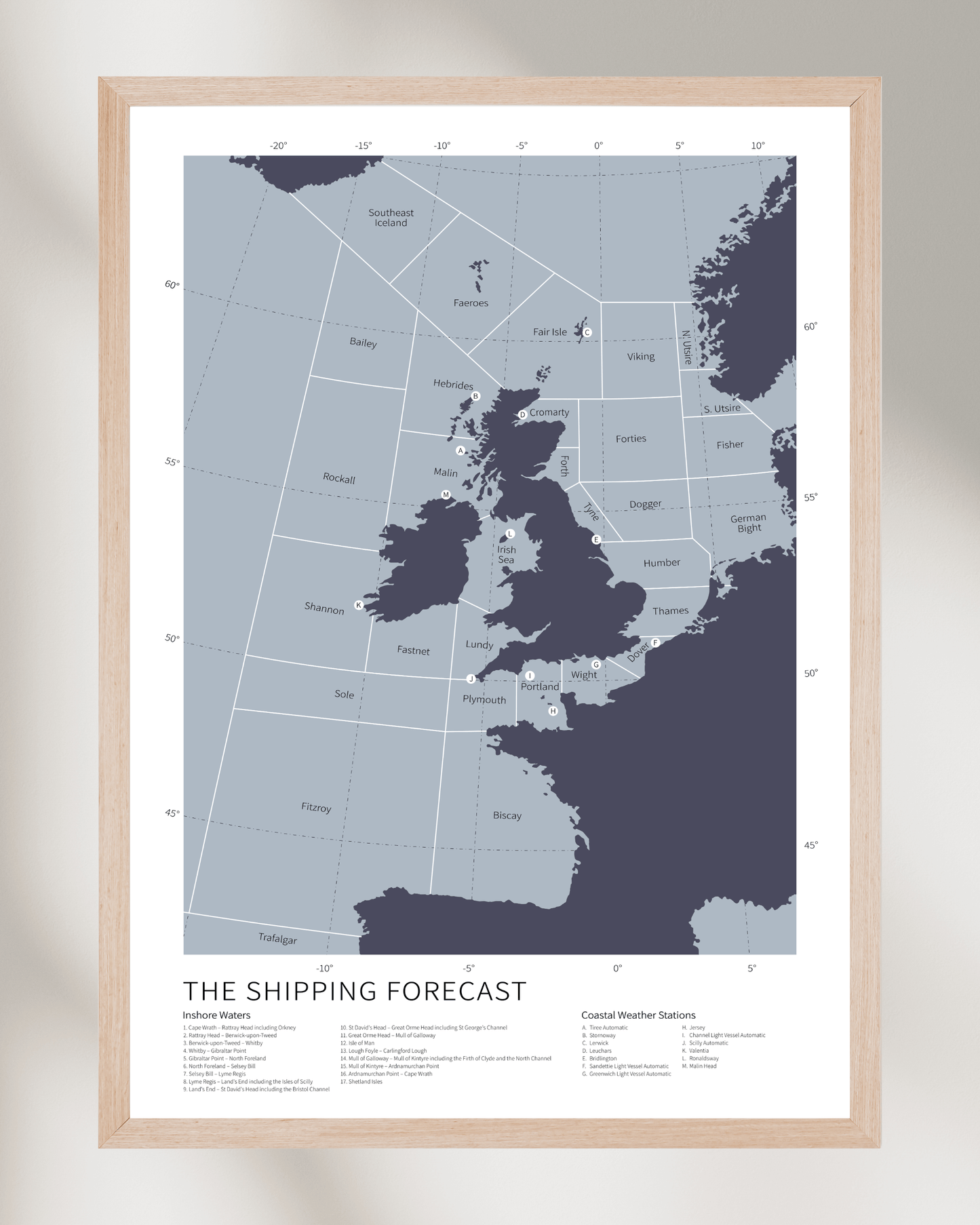
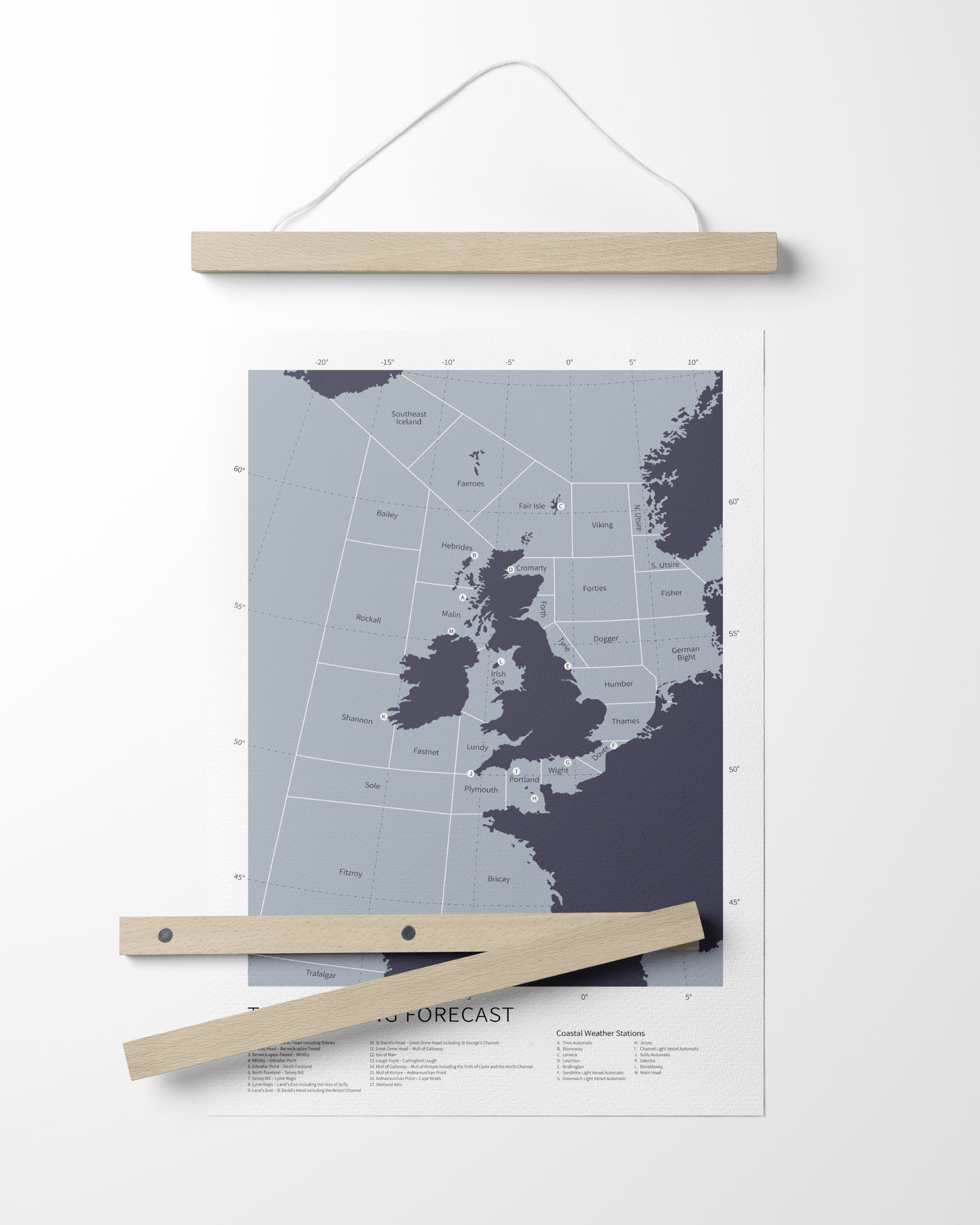
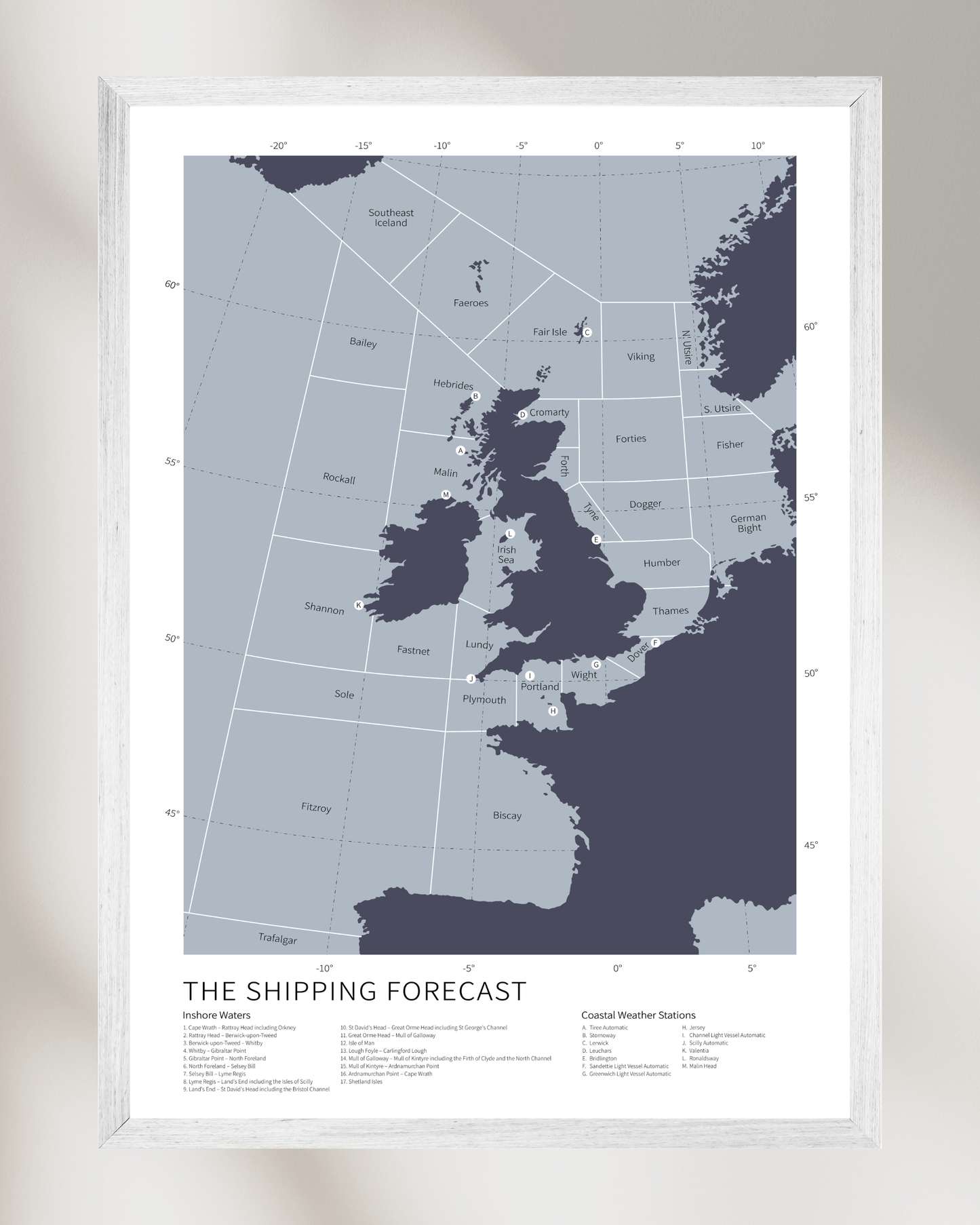
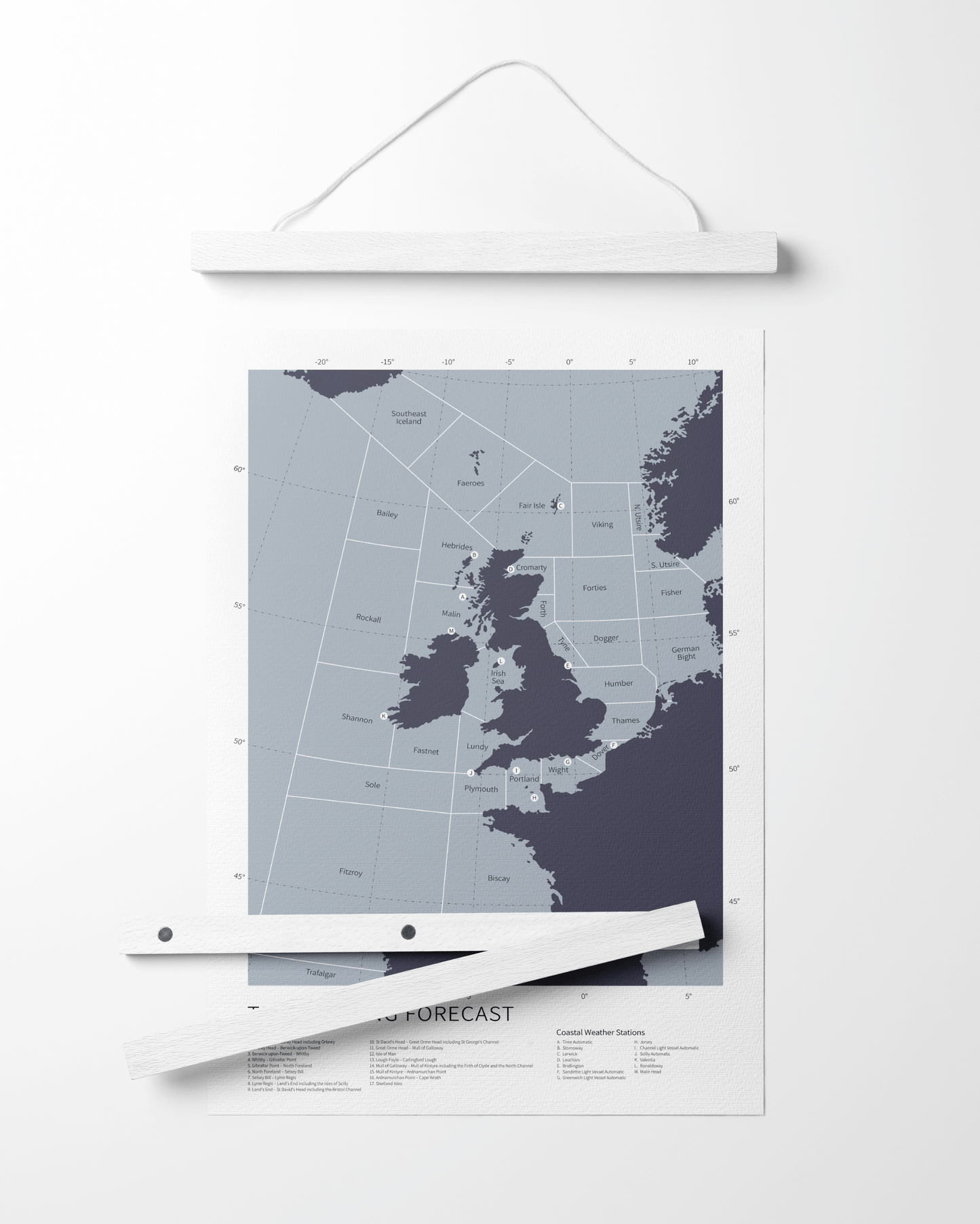
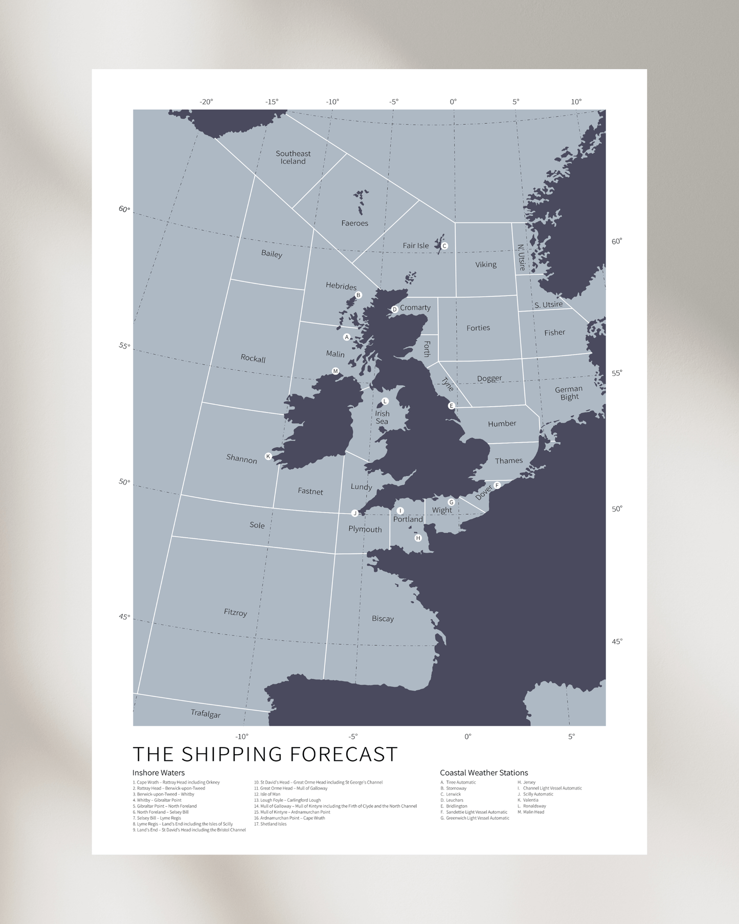
The Shipping Forecast is a specialised weather report issued by the UK Met Office and broadcast by BBC Radio 4. It provides forecasts for 31 designated sea areas around the British Isles, offering vital meteorological data to mariners. Each bulletin includes wind direction, wind strength (using the Beaufort scale), precipitation, visibility, and general conditions.
When is the Shipping Forecast broadcast?
It airs twice daily on BBC Radio 4: at 00:48 & 05:34, with an additional broadcast at 17:54 at the weekend. The late-night broadcast is especially well-known for its somewhat hypnotic delivery and almost meditative effect. It was first broadcast on BBC Radio on 4 July 1925.
Why do people find the Shipping Forecast so comforting?
For many listeners, the Forecast is a touchstone of stability. Its unchanging format, familiar names, and quiet tone provide a sense of order and calm. Whilst some listeners are at sea, relying on the contents to help navigation and ensure safety, the Forecast also offers a connection to something elemental and enduring to those on terra firma.
What are some of the most iconic sea-area names?
Names such as Dogger, Viking, Humber, Lundy, and Rockall have become part of the national lexicon. Their musicality and unfamiliarity evoke both intrigue and nostalgia. These names refer to specific maritime zones used in navigation and forecasting, and are instantly recognisable.
How accurate is the Shipping Forecast?
The Forecast is produced by professional meteorologists at the Met Office, using sophisticated modelling and satellite data. For mariners, it remains a vital resource, particularly in the North Atlantic and North Sea, where conditions can shift rapidly.
Who listens to the Shipping Forecast?
While its original audience was seafarers, the Forecast now draws a diverse listenership: insomniacs, writers, artists, radio enthusiasts, and those simply enchanted by its ritualistic form. It has also gained a quiet international following.
Has the Shipping Forecast ever changed?
The core format has remained remarkably consistent, though sea area names have occasionally been adjusted. For example, "Finisterre" was renamed "FitzRoy" in 2002, in honour of Vice-Admiral Robert FitzRoy, the founder of the Met Office.
Why are the sea areas arranged in such a specific order?
The Forecast follows a traditional clockwise route. Beginning at Viking and ending its journey at Southeast Iceland, it circumnavigates around the entirety of the British Isles and never deviates, thus ensuring each area is covered in the broadcast
Is it possible to plot the Shipping Forecast on a map?
Yes. The 31 sea areas each occupy a defined region in the waters surrounding the UK and Ireland. Cartographic renderings of these areas help bring the Forecast to life for those on land.
Where can I buy a map or poster of the Shipping Forecast?
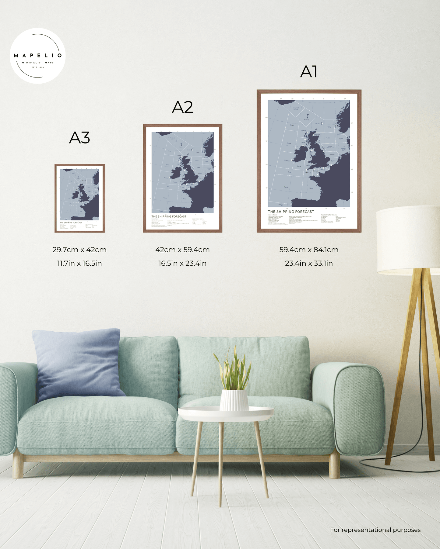
The best place to get an accurate and beautifully designed map of the Shipping Forecast is from Mapelio, where framed, fine art prints of the Forecast are available in a variety of sizes and frame styles.
What makes a good Shipping Forecast map?
A well-executed map must balance geographical clarity with aesthetic sophistication. It should accurately delineate the sea areas while capturing the visual rhythm and elegance befitting such a storied subject.
Why do people give Shipping Forecast maps as gifts?
The Forecast is deeply nostalgic for many - evocative of childhood, travel, coastal holidays, or quiet late nights. A map of the Shipping Forecast makes for a meaningful gift: poetic, personal, and steeped in British identity.
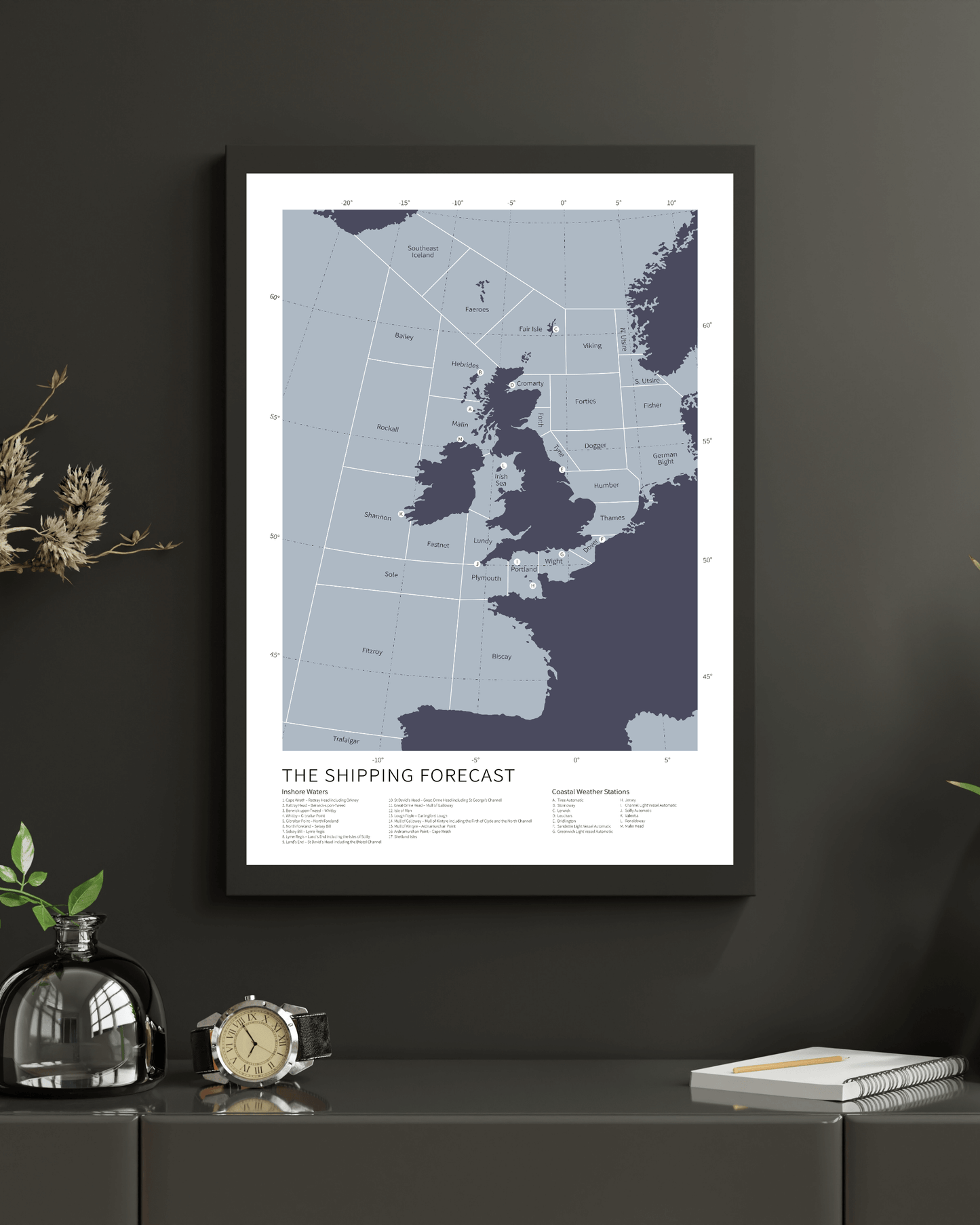
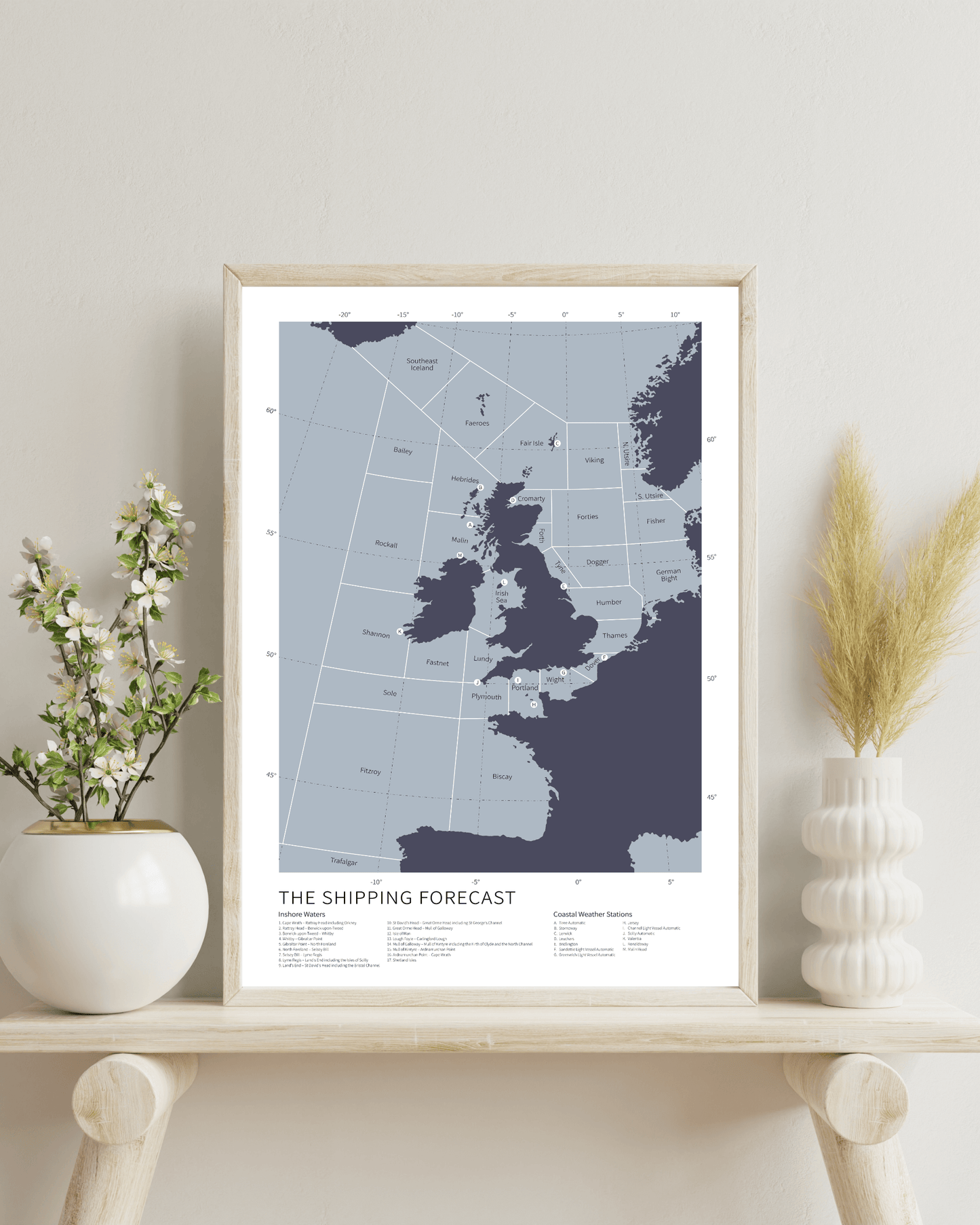
How can a Shipping Forecast map work as home decor?
Its minimalist palette, maritime theme, and typographic beauty lend themselves to a variety of interiors: coastal, Scandinavian, modern British, or academic. It often becomes a conversation piece as well as a design element.
Are Shipping Forecast maps historically accurate?
If produced with proper research, yes. Each sea area has fixed boundaries defined by the Met Office. High-quality maps honour these specifications while adding visual refinement.
Is the Shipping Forecast unique to Britain?
Yes. While other countries offer maritime forecasts, none match the Shipping Forecast in form, heritage, or cultural significance. It remains a singularly British phenomenon - part utility, part national poem.
Has the Shipping Forecast appeared in literature or popular culture?
Absolutely, the Shipping Forecast has made subtle yet memorable appearances across British cultural life. One of my earliest memories of hearing it referred to was in Barry Hines's novel A Kestrel for a Knave, where the young protagonist, Billy Casper, shouts out "German Bight" when the name "Fisher" is called during the school register. The moment, both humorous and poignant, speaks to the subconscious hold the Forecast has on the national imagination.